Seasonal Spotlight
Fall Color Hikes in Santa Clarita: Rice Canyon & the St. Francis Dam Trail
Yes, the Santa Clarita Valley has real fall color, and it peaks right around now. Sam's two favorite spots to see the maples, walnuts, and sycamores turn gold are the Rice Canyon loop and the St. Francis Dam National Monument walk. Here is everything you need to plan both.
September 15, 2026 Sam Silver 7 min read
Rice Canyon Loop
1.2 mi
easy to moderate
St. Francis Walk
3.2 mi
out-and-back
Best Season
Sep-Nov
peaks mid-October
Foliage
Gold
maple, walnut, sycamore
When people ask Sam what there is to do in Santa Clarita in the fall, the answer almost always starts with a hike. The summer heat finally breaks, the creeks start running, and the canyon woodlands put on a quieter, more subtle show of color than you will find anywhere else in Southern California. The two best places to catch it are the Rice Canyon loop in the Santa Clarita Woodlands Park and the St. Francis Dam Disaster National Monument walk up San Francisquito Canyon.
Neither is a secret to locals, but both are easy to miss if you do not know where the trailheads are. This guide covers distances, directions, what the color looks like, and when to go, so you can plan a proper fall outing that is close to home and genuinely beautiful.
Rice Canyon Loop
The trail: The Rice Canyon Loop Trail is about 1.2 miles and easy to moderate, crossing the creek a few times. It threads through some of the valley's best autumn woodland, with bigleaf maple, California black walnut, sycamore, and three species of oak.
Getting there: From I-5, exit Calgrove Blvd and head west as it becomes The Old Road. The East & Rice Canyon trailhead parking is about 0.9 mile south on the west side of The Old Road, near 23801 The Old Road in Newhall.
Amenities: A day-use parking fee (a few dollars), restrooms, and a picnic area. Bring water, but the loop itself is a light morning walk.
St. Francis Dam National Monument
The trail: A roughly 3.2-mile out-and-back with only about 150 feet of gain along the abandoned Old San Francisquito Canyon Road, which is closed to vehicles. The old road and creek burst into autumn color in the fall, and you finish at the ruins of the dam that failed in 1928.
Getting there: Drive San Francisquito Canyon Road north of Santa Clarita. Park at the dirt turnout with the barricade, about a mile past the stop sign at Stator Lane. There is no developed trailhead, so expect uneven footing and loose rock.
Amenities: None. No restrooms, no water, no shade in spots. This is a history hike first and a nature hike second, and that is exactly why Sam loves it.
On the Trail
Where the Valley's Forests Turn Gold
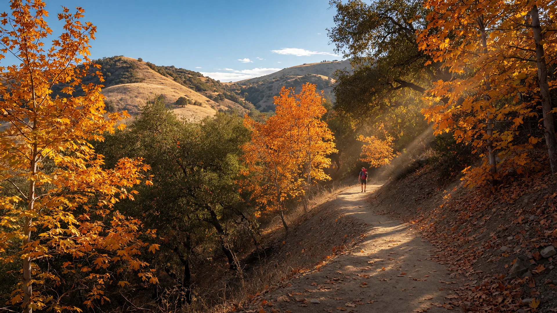
Rice Canyon is the closest thing Santa Clarita has to a classic New England fall scene, just smaller and scattered. The color comes in pockets: a bigleaf maple glowing orange against a backdrop of green live oak, a California black walnut dropping golden leaves across the trail, sycamores turning amber along the creek. It is not a solid wall of color, so the trick is to go when the light is low, late afternoon, and let the sun turn each pocket into its own small show.
Timing matters more here than anywhere else in the valley. The color generally runs from late September through November and peaks in mid-October, right when the summer crowds are gone and the creek is starting to flow again. Sam's rule of thumb: hike Rice Canyon the same week you start thinking about pumpkin patches, and you will hit the window nearly every year.
The St. Francis Dam walk is different in every way except the color. The old canyon road climbs gently through sycamore and willow along San Francisquito Creek, and in the fall the foliage along the route turns gold in long, shaded stretches. Because the road is closed to traffic, the whole walk feels quiet and a little eerie, which fits the story waiting at the far end.
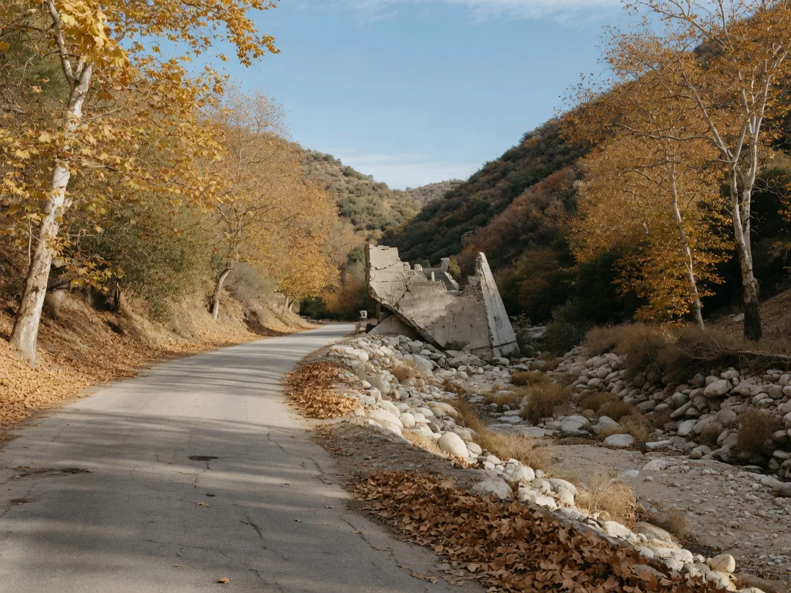
The old road to the St. Francis Dam ruins turns gold in the fall, a quiet history walk through San Francisquito Canyon.
A History Walk
The Story at the End of the Road
At the end of the old road stands the broken remains of the St. Francis Dam, one of the most consequential failures in California history. The concrete gravity dam was built between 1924 and 1926 under city engineer William Mulholland to hold Los Angeles's water supply in San Francisquito Canyon.
Just before midnight on March 12, 1928, roughly two minutes shy of 12, the dam failed catastrophically on its first full filling. An estimated 12 billion gallons of water, a wall reported as high as 80 to 140 feet, tore down the canyon and followed the Santa Clara River all the way to the sea, a path of destruction about 55 miles long through Castaic, Newhall, Valencia, Piru, Fillmore, and Santa Paula. The flood destroyed Powerhouse No. 2 and an Edison construction camp, and the death toll is generally put at more than 450 people.
The failure ended Mulholland's career and changed how California builds dams. The site was designated a California Registered Historical Landmark and became a National Monument in 2019. Today you can walk right up to the ruins, which modern studies connect to an unstable, ancient landslide foundation on the canyon's south side. It is a sobering, fascinating place, and the quiet fall setting only deepens the impact.
"Most people come to Santa Clarita for Six Flags or the paseos, but the St. Francis Dam walk is the most meaningful hike in the whole valley. You get golden fall color and a hard piece of California history in the same two miles. I bring every client who wants to understand this area before they ever look at a house."
Pick Your Hike
Which One Should You Hike?
Both are worth doing, but here is how Sam would decide on any given weekend.
Hike Rice Canyon if...
- You want the fullest pockets of fall color close to town.
- You want restrooms, parking, and a picnic area for a family outing.
- You have about an hour and want an easy to moderate loop.
Hike the St. Francis Dam if...
- You want history with your foliage, ending at National Monument ruins.
- You are comfortable with uneven, rocky footing and no facilities.
- You have 90 minutes to two hours for the full out-and-back.
Sam's Fall Hike Packing List
Water & Snacks
Fall mornings are cool, but the exposed canyon miles still warm up fast.
Grippy Footwear
Rice Canyon crosses the creek a few times; the old dam road is loose rock.
Camera
Late-afternoon light turns the maple pockets orange. Golden hour is the money shot.
Downloaded Map
Cell service thins out up San Francisquito Canyon Road. Save your map before you go.
Sam's Timing Tips
When to Go for the Best Color
Late September through November is the reliable window, with the peak usually landing in mid-October. Early in the window you get the first maples turning; by late October the walnuts and sycamores have caught up.
Mornings are the quietest time on both trails, but late afternoons have the light. If Sam only gets one slot a week, he goes at 3:30 PM on a weekday, when the sun drops low enough to backlight the leaves and the trails are nearly empty. For the St. Francis walk, keep an eye on creek conditions after rain, the old road can hold water in shaded stretches.
Explore More
More SCV Trails Worth Your Weekend
Rice Canyon and the St. Francis Dam are two of Sam's fall favorites. Here are more of his go-to trails across the valley.
Elsmere Canyon
A 3.1-mile loop through volcanic rock, oak woodlands, and 14 creek crossings. Sam's best-kept secret.
Full trail guideWhitney Canyon Park
Oak forest trail with a seasonal waterfall. 2.9 miles out-and-back, best January through June.
Full trail guideHidden Hiking Trails
Wildwood Canyon and more of Sam's favorite lesser-known open spaces across SCV.
Read the guideKnow Before You Go
Fall is the best season to explore the valley's open space, and these two hikes are a perfect way to show newcomers why Santa Clarita is such a great place to live. Both trails are friendly to a range of fitness levels, but neither has reliable cell service in its lower stretches, so download your map first.
And pack out everything you bring in. These are the places that make SCV special, and Sam's motto is simple: leave every trail better than you found it.
Your Guide to Living in SCV
Fall color is just the beginning. Sam's SCV Life blog covers every trail, neighborhood, school, and event that makes Santa Clarita Valley one of Southern California's best places to call home.