Hidden Gem
Elsmere Canyon Trail — SCV's Best-Kept Hiking Secret
A 3.1-mile loop through volcanic rock formations, oak woodlands, and seasonal creek crossings that most Santa Clarita locals have never explored. Here's everything you need to know.
July 24, 2026 Sam Silver 6 min read
Distance
3.1 mi
loop trail
Difficulty
Moderate
~740 ft gain
Feature
Hidden
gem status
Terrain
Volcanic
rock & creek
Every valley has its hidden spots — the trails that even some longtime locals haven't hiked. In Santa Clarita, Elsmere Canyon is one of those places. Tucked between the 14 freeway and the Angeles National Forest boundary, this 3.1-mile loop trail weaves through volcanic rock formations, crosses a seasonal creek a dozen times, and delivers sweeping views that make you forget you're minutes from a major freeway.
What makes Elsmere Canyon special isn't just the scenery — it's the story. This canyon was once slated to become the world's largest landfill. Local activists fought for years to protect it, and today it stands as a preserved open space, a testament to what happens when a community rallies around its natural heritage. Sam has been hiking Elsmere for over a decade and considers it one of the most underrated trails in the entire valley.
Getting There
Main trailhead: The most direct access is from the intersection of Sierra Highway and Remsen Street, just south of Eternal Valley Cemetery. Look for the Elsmere Canyon gate near the cemetery entrance.
Alternate access: You can also reach Elsmere Canyon via Whitney Canyon Park. Park at the Whitney Canyon trailhead at 20303 Newhall Ave, Santa Clarita, CA 91321 and follow the connector trail north into Elsmere Canyon. This adds about a mile each way to your hike.
Parking: Limited street parking near the Sierra Highway entrance. The Whitney Canyon lot is larger but fills on weekends. Arrive early.
When to Go
Best season: Fall through spring (October through May). Temperatures are mild (60–80°F), the creek is flowing, and the canyon is at its greenest. Winter rains bring the landscape to life with wildflowers and flowing water.
Summer: Possible but challenging. Temps hit 95–105°F and much of the trail is exposed. If you go, start before 7 AM, bring at least 2 liters of water, and expect to share the trail with rattlesnakes (common in summer).
Weekdays vs. weekends: Weekdays are nearly empty — you might have the canyon to yourself. Weekends see moderate use, especially from the Whitney Canyon side. Sam recommends a mid-week morning for the full solitude experience.
On the Trail
What Makes Elsmere Canyon Special
The Elsmere Canyon Loop is roughly 3.1 miles with about 740 feet of elevation gain — moderate enough for reasonably fit hikers but with enough incline to feel like a real workout. The trail climbs gently at first through open grassland dotted with coastal sage scrub, then enters the canyon proper where the landscape transforms dramatically.
The volcanic rock formations are the trail's signature feature. Elsmere sits on the edge of the San Gabriel Mountains' ancient volcanic zone, and the trail winds through dark, weathered rock outcroppings that feel prehistoric. These formations create natural viewpoints and photo opportunities throughout the hike.
The creek crossings are the other highlight. Depending on the season, you'll cross Elsmere Creek anywhere from 10 to 14 times via stepping stones, logs, or shallow water. After winter rains, the sound of flowing water follows you through the entire canyon — a surprisingly immersive experience this close to the freeway. Sam's advice: wear shoes with good grip, as the rocks get slippery when wet.
About a mile in, you'll pass the remnants of old oil infrastructure — rusted pipes and concrete foundations from the canyon's early 20th-century oil boom days. These industrial artifacts are a tangible reminder of SCV's oil heritage, which stretches back to the 1870s when the region produced California's first commercially viable oil at nearby Pico Canyon.
Near the top of the loop, the trail opens onto a ridgeline with sweeping views of the Santa Clarita Valley to the west and the San Gabriel Mountains to the east. On clear days, you can see all the way to the Pacific Ocean. This is the payoff after the climb — and the perfect spot for a snack break and photos.
Volcanic Formations
Dark, weathered rock outcroppings create a dramatic landscape that feels a world away from the suburbs. Great for photography and scrambling.
14 Creek Crossings
Elsmere Creek crosses the trail over a dozen times via stepping stones. After winter rains, the sound of flowing water makes the hike feel incredibly remote.
Rich History
From oil boom artifacts to the canyon's conservation story — Elsmere is steeped in SCV history. It was nearly a landfill and is now a protected preserve.
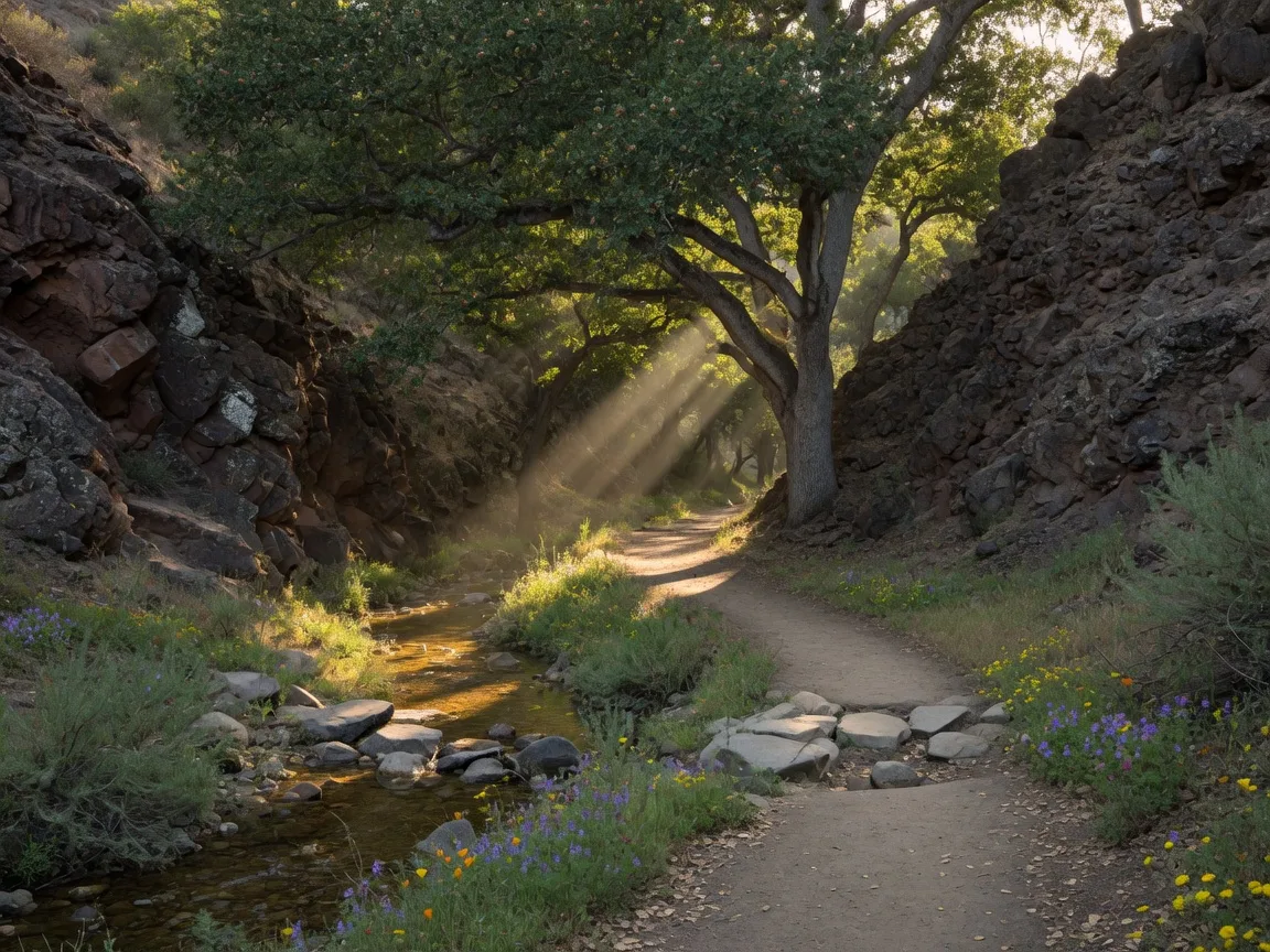
The lower canyon section of Elsmere Canyon Trail features shaded oak woodlands and frequent creek crossings that make the hike feel remote and peaceful.
Sam's Elsmere Canyon Packing List
Extra Water
Bring at least 2 liters. The exposed upper section gets hot, even in spring.
Grippy Shoes
14 creek crossings means wet, slippery rocks. Trail runners with good tread.
Camera
The volcanic rock formations and valley views from the ridgeline are worth capturing.
Downloaded Map
Cell service is spotty in the canyon. Download the AllTrails map before you go.
Conservation
The Canyon That Almost Wasn't
One of the most remarkable things about Elsmere Canyon is that it exists at all. In the late 1980s and early 1990s, the canyon was the leading candidate for the world's largest landfill — a project that would have accepted thousands of tons of Los Angeles garbage every day and buried this canyon's natural beauty under decades of refuse.
A coalition of local activists, environmental groups, and community leaders fought the proposal for years. They argued that the canyon's sensitive ecology, proximity to the Santa Clara River watershed, and the devastating impact on quality of life made it unsuitable. The fight was long, expensive, and hard-fought — but in the end, the community won.
Today, Elsmere Canyon is a protected open space managed by the Mountains Recreation and Conservation Authority. Every time you hike its trails, you're walking through a living monument to what community advocacy can achieve. It's a powerful reminder that so much of what makes Santa Clarita Valley special — our trails, parks, and open spaces — exists because people fought to protect them.
"Elsmere Canyon is one of my favorite hikes in SCV not just because it's beautiful, but because of what it represents. This canyon was almost lost — it was almost a landfill. The fact that we get to hike through it today is because people in this community stood up and said 'not here.' Every time I take the trail, I feel grateful for that."
Explore More
More Hidden Trails Worth Discovering
Elsmere Canyon is just one of many hidden gems across Santa Clarita Valley. Here are more of Sam's favorite lesser-known trails.
Whitney Canyon Park
Oak forest trail with a seasonal waterfall. 2.9 miles out-and-back. The waterfall is best January through June.
Full trail guideWildwood Canyon Open Space
A 95-acre hidden gem tucked in Newhall with oak-dotted ravines and commanding ridge views.
Read the guideAll SCV Outdoor Adventures
Complete guide to every trail, park, and outdoor activity in Santa Clarita Valley.
Things to DoKnow Before You Go
Elsmere Canyon is best hiked clockwise (the standard loop direction) to get the climb out of the way early and enjoy the ridge views as a reward. The trail is not well-marked in a few sections, so having the AllTrails map downloaded on your phone is a smart move. Cell reception is unreliable in the canyon bottom.
And one more thing: please pack out everything you bring in. This canyon was saved from becoming a landfill — let's keep it pristine for the next hiker. Sam's motto: leave every trail better than you found it.
Your Guide to Living in SCV
Elsmere Canyon is just the beginning. Sam's SCV Life blog covers every trail, neighborhood, school, and event that makes Santa Clarita Valley one of Southern California's best places to call home.